DevBlog #03 - Terrain Creation
We want the Colonize game to have accurate maps, authentic scenery, trees, animals, mountains, meadows, and everything as it was in the 17th century. We try to get as close to it as possible, so we make each map according to the elevation map of the given area.
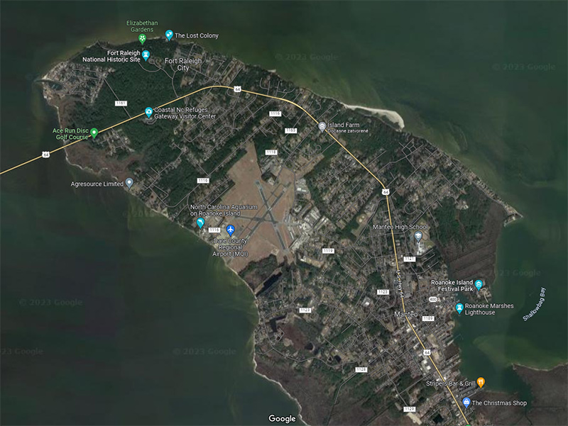
[h3]Let's show you how we created the Roanoke map![/h3]
The environment of the first Roanoke Colony, located on Roanoke Island off the coast of North Carolina, was a mix of coastal plains, forests, and wetlands. The region was also known for having abundant resources, such as timber and fertile soil, which helped the colony establish itself.
We chose a part of Roanoke Island, specifically around the city of Fort Raleigh. Currently, you can see that there is an airport, and the overall development of the given area is relatively large. Almost most of the land is already in use. That's why we had to invent a little and adapt the terrain to our needs.
As for technical restrictions, the terrain must be 1x1km in size, have a maximum height of 30-35m, and the construction area of the land is 1m above sea level and must be completely flat. That's why we had to re-engage some semi-automatic processes in the Houdini program, which we already introduced last time.
For input, you have raw data, mostly in poor quality, but they serve well. The data goes through several changes, adding various noise displacements, adjusting the beaches, defining the constructible surface, and meeting all the technical conditions mentioned above.
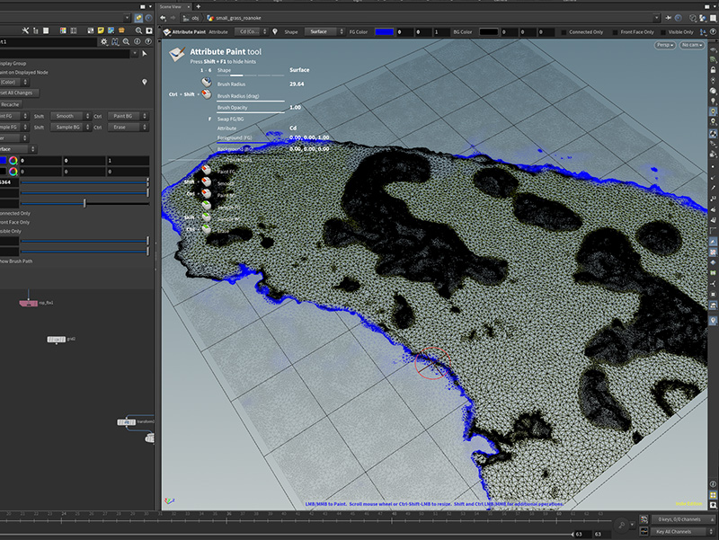
Next, painting the required masks for the shader to create the final appearance in Unity is necessary, but more on that later.
[h3]Let's show you how we created the Roanoke map![/h3]
The environment of the first Roanoke Colony, located on Roanoke Island off the coast of North Carolina, was a mix of coastal plains, forests, and wetlands. The region was also known for having abundant resources, such as timber and fertile soil, which helped the colony establish itself.
We chose a part of Roanoke Island, specifically around the city of Fort Raleigh. Currently, you can see that there is an airport, and the overall development of the given area is relatively large. Almost most of the land is already in use. That's why we had to invent a little and adapt the terrain to our needs.
As for technical restrictions, the terrain must be 1x1km in size, have a maximum height of 30-35m, and the construction area of the land is 1m above sea level and must be completely flat. That's why we had to re-engage some semi-automatic processes in the Houdini program, which we already introduced last time.
For input, you have raw data, mostly in poor quality, but they serve well. The data goes through several changes, adding various noise displacements, adjusting the beaches, defining the constructible surface, and meeting all the technical conditions mentioned above.
Next, painting the required masks for the shader to create the final appearance in Unity is necessary, but more on that later.